Claire Chadwick; Lauren Maurizio; Robin Humphreys; and Vijay Vulava
Plate Boundaries
Watch the short introduction video to learn the basics of plate tectonics, the internal structure of Earth where earthquakes occur, and plate interactions that can result in earthquakes. As always take notes as you watch the video below.
Exercise 2 – Plate Boundaries and Associated Faults
Answer the following questions about the plate boundaries:
- What layer of the Earth are tectonic plates made of?
- List the two types of lithospheres.
- Identify the three types of plate boundaries.
- Match the three types of plate boundaries with how the plates interact: Pull apart, Collide/converge, or Sliding past each other
- Match the three fault types with how the hanging wall fault block moves relative to the foot wall: Hanging Wall/Foot Wall/Neither goes down
- Match the three fault types with how they experience stress: Tensional/ Compressional/Shear stress
- Match the three fault types with the plate boundaries where they may occur: Divergent/Convergent/Transform plate boundaries
- Earthquakes occur in one of these physical layers: Brittle/Ductile
- More than 75% of all earthquakes on Earth occur in this type of plate boundary.
Exploring the Tectonic Features on Earth
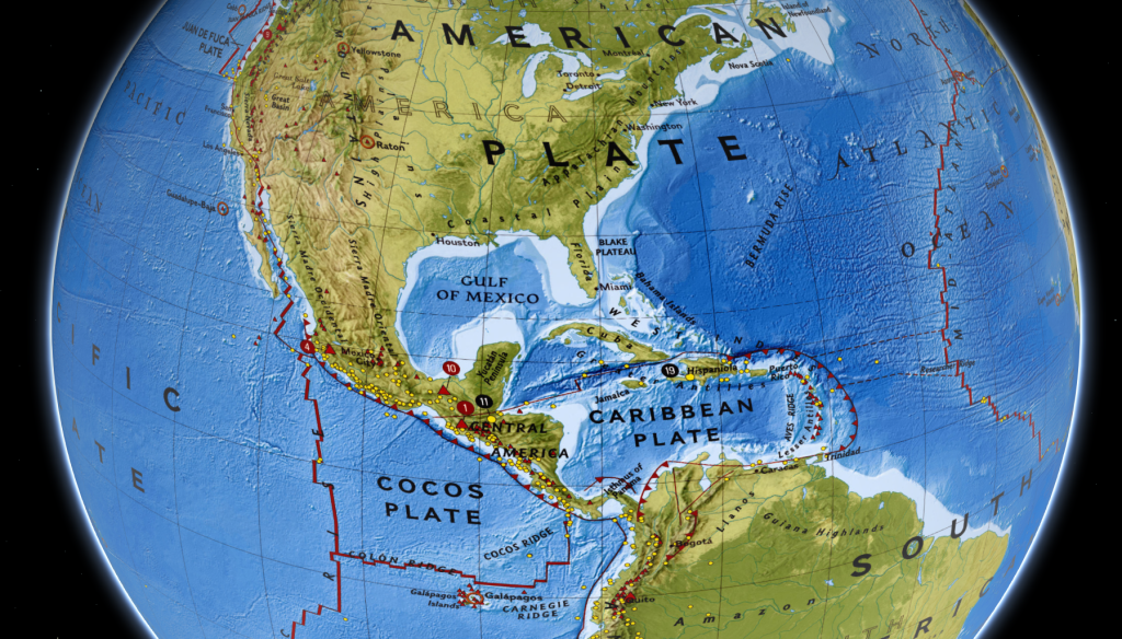
In the interactive map below, you can explore the different kinds of plate boundaries. Can you identify the different types of boundaries from the three hatch patterns applied to the boundaries?

Exercise 3 – Exploration of Plate Boundaries
Let’s explore some of the locations around the world and the types of plate boundaries at these locations.
- 2 Plate Tectonics – An Introduction to Geology (opengeology.org)
- 9 Crustal Deformation and Earthquakes – An Introduction to Geology (opengeology.org)
- 11.2 Earthquakes and Plate Tectonics – Physical Geology – 2nd Edition (opentextbc.ca)
- Use the interactive map above – click on the image above to access the map.
- Match the three boundary types with the patterns shown in the map above: Saw-tooth patterned lines, thick red lines, thin red lines
For each of the regions listed below identify the following: (i) type of plate boundary (convergent, divergent, transform), (ii) dominant fault type (normal, reverse/thrust, and strike-slip), (iii) names of major tectonic plates, (iv) other geological features (mountains, trenches, volcanoes, etc.)
- San Andreas Fault
- Andes Mountains
- Aleutian Island Chain
- Himalaya Mountains
- Atlantic Mid-Ocean Ridge
In the map above, major earthquakes recorded near the plate boundaries are shown as yellow-colored dots, while volcanoes are shown as red-colored rectangles.
- Some types of convergent boundaries are called subduction zones. Describe how these convergent boundaries are different from other convergent boundaries.
- Which of the following regions are subduction zones? San Andreas Fault, Andes Mountains, Aleutian Island Chain, Himalaya Mountains, Atlantic Mid-Ocean Ridge
Examine two subduction zones shown in Figures 11.2.3 and 11.2.4 at 11.2 Earthquakes and Plate Tectonics. The dense oceanic plate subducts, while the less-dense continental plate is called the overriding plate. A deep trench forms at the plate boundary here.
- Using information from figure 11.2.3, match the subducting and overriding plates.
- According to data in Figure 11.2.3 where do shallow earthquakes (0-33 km depth) occur? Closer to the plate boundary or farther away from the boundary?
- The depth of the earthquake (hypocenter) increases as the distance increases from the plate boundary (trench) increases. T/F
- Shallow-to-deep earthquakes are associated with subduction zones. T/F
- Subduction occurs at convergent plate boundaries having which two types of crust converging? Continental-Oceanic, Continental-Continental, or Oceanic-Oceanic
- Examine the map of the earthquake pattern in Figure 11.2.4. Based on your understanding of subduction zones, is subduction occurring in the Himalaya Mountains? Yes/No
- Explain your answer to the previous question.

