
7.1 Maps, Society, and Technology
Steven Manson and Laura Matson
The standard or dictionary definition of a map usually revolves around the idea that a map is a representation, usually on a flat surface, of an area. The Wiktionary, for example, defines a map as “a visual representation of an area, whether real or imaginary.”
This definition is not very useful on its own, so in order to figure out what maps are about, we usually instead look at what maps do.
In particular, maps:
- Show an area larger than we can see. Most often this view is from above but not always.
- Present information concisely, especially the features of most interest to the user.
- Demonstrate spatial relationships.
- Show things we cannot see directly, such as minerals below ground or records of daily temperatures.
It is also helpful to look at kinds of maps in addition to what they do. We can distinguish between two major kinds of maps: reference maps and thematic maps.
Reference maps store data and show a variety of features for a variety of uses. These maps function like general storehouses of information. The figure below is a reference map of China because it stores a variety of information, including transportation routes, rivers, and names of water bodies.
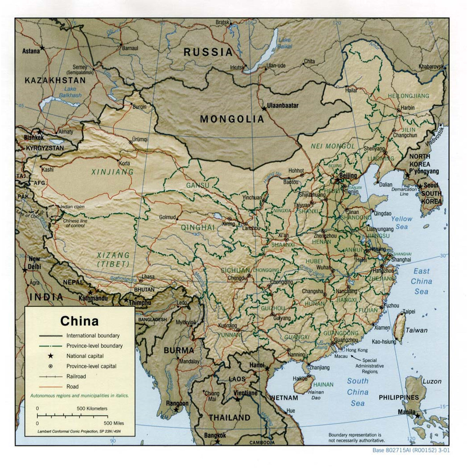 Reference map of China. This map is considered a reference map because it shows many different features of interest, such as rivers, roads and boundaries. [1]
Thematic maps highlight specific themes. Their chief goal is to focus the user’s attention on specific features or characteristics. The figure below has two thematic maps that each draw the user’s attention to a single idea or theme. The other information, such as the outlines of states, is only provided to help understand the main theme—vegetation and population, respectively.
 Thematic maps of Thailand. These maps are considered thematic because they focus on a single item or theme. On the left is a categorical thematic map showing nominal classes of vegetation in 1974, and on the right is a quantitative thematic map showing ordinal classes of population density in 1974. [2]
Regardless of whether a map is thematic or reference, it is essentially a technology in that it is the manifestation of knowledge gained from many fields and forms of knowledge. These include cartography, land surveying, remote sensing, computer science, information science, and social science. A map is also a social entity, in that society affects everything from the underlying data used in the map through how it is processed into information, converted into knowledge about the world, and ultimately turned into intelligence that is used for action.
- In the public domain in the United States because it is a work prepared by an officer or employee of the United States Government as part of that person’s official duties under the terms of Title 17, Chapter 1, Section 105 of the US Code. ↵
- CC BY-NC-SA 3.0. Adapted from Adrienne Gruver (2016). Cartography and Visualization. https://www.e-education.psu.edu/geog486/node/1848 Courtesy of University of Texas. ↵
A map that delivers location information to the map user.
Maps concerned with a particular theme or topic of interest, and how things are distributed across space.
