2.7 Hot Spots
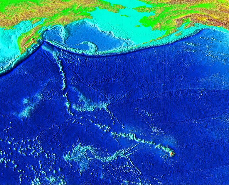
One key to unravelling J. Tuzo Wilson’s Theory of Plate Tectonics was his investigation of the Hawaiian Islands. These islands have been formed by volcanic activity in the middle of the Pacific Plate with no apparent plate boundaries for hundreds of miles. However, a close examination of each of the islands, reveals something interesting; the big island of Hawaii is the youngest of the chain, whereas the age of the islands steadily increases to the Northwest.

What does this progression in age tell us? Unlike most volcanism on our planet, the volcanic activity at Hawaii occurs from a hot spot. A hot spot begins deep in the lower mantle when hot molten material melts and begins to move upward through the lower and upper mantle toward the crust. Eventually, this material may erupt at the surface as a volcano without the need of any plate boundaries; it is an isolated spot of volcanic activity.
Hot spots that erupt in the middle of oceanic lithosphere do create brand new crust. In the case of the hot spot in the middle of the Pacific Ocean, it creates a volcanic mountain that rises enough in elevation to potentially become a brand new island. This first happened about 81-85 million years ago to form the first guyot in what is now known within the Emperor Seamount Chain.
Today, we can see hundreds of islands, seamounts, and guyots making up a v-shaped chain in the Pacific ocean in what we call the Hawaiian-Emperor Seamount Chain. How did so many islands form from a single source of magma? Did the hot spot move over time? J. Tuzo Wilson thought about plate motion and reasoned that the Pacific Plate must be drifting slowly over tens of millions of years, while the hot spot remained relatively stationary. Thus, as the Pacific plate moved, and even changed directions (causing the bend in the V), multiple new islands were created to form the Emperor Seamounts and the Hawaiian Islands.
The proof of this systematic process can be found in the ages determined in each of the islands themselves. The big island where the hot spot is currently located is approximately 400,000 years old [15]. Below is a table that demonstrates the increase of age for some of the major landforms in the island and seamount chains.
| Landform Name | Approximate Age [15] (Myr) | Distance from Hotspot (km) |
| Hawai’i | 0-0.4 | 0-54 |
| Maui | 0.8 – 1.3 | 182-221 |
| O’ahu | 2.6 – 3.7 | 339 – 374 |
| Kaua’i | 5.1 | 519 |
| Nihoa | 7.2 | 780 |
| Necker | 10.3 | 1058 |
| Gardner | 12.3 | 1435 |
| Laysan | 19.9 | 1818 |
| Midway | 27.7 | 2432 |
| Abbott Seamount | 38.7 | 3280 |
| Koko Seamount | 48.1 | 3758 |
| Jingu Seamount | 55.4 | 4175 |
| Suiko Seamount | 59.6 – 64.7 | 4794 – 4860 |
Calculating Relative Plate Motion from Hotspots
The approximate age of the Island of Hawai’i is 0.4 million years and it is at maximum 54 kilometers from the active hotspot. To determine the average motion of the Pacific Plate over this time, let us consider the following equation:
Movement Rate = Distance / Time
54,000 m / 400,000 years = 0.135 m / year
On average, the Pacific Plate moved about 0.135 meters (or 13.5 centimeters) each year over the past 54 million years. That means that it moved an average of 1 foot each year!
Go to Google Earth
Backyard Geology: The San Francisco Volcanic Field 
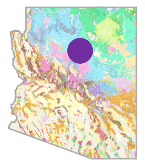
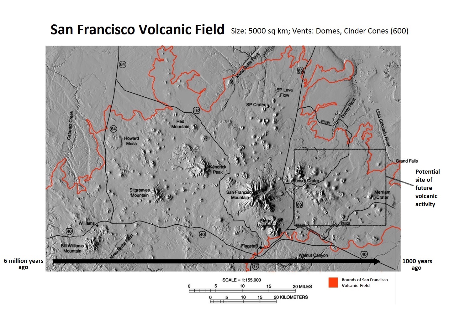
Hot spots are not only restricted to island chains in the middle of the ocean. They are also very close to home, in what is called the San Francisco Volcanic Field. This region covers about 5000 square kilometers of Northern Arizona, and in this relatively small portion of the state there are approximately 600 volcanoes. The majority of these are mafic cinder cone volcanoes that have deposited basaltic lavas over the past 6 million years. However, scientists have noticed that the ages of these volcanoes decrease moving to the east. Because the North American plate steadily moves to the west, it is likely that the volcanoes in this region have formed from a hot spot. Among the youngest of these can be found at Sunset Crater National Monument Park, where the namesake volcano last erupted just 900 years ago [16].

***See 2.10 for Text and Media Attributions
The theory that the outer layer of the Earth (the lithosphere) is broken in several plates, and these plates move relative to one another, causing the major topographic features of Earth (e.g. mountains, oceans) and most earthquakes and volcanoes.
A type of volcanic activity, that occurs independent of plate boundaries, in which a plume of molten magma from deep within the mantle upwells at the Earths surface.
The outer, relatively rigid layer of the Earth that responds to the emplacement of a load by flexural bending.
a submarine mountain that has a distinctive, flat top.
a submarine mountain
molten rock that can be found beneath the Earth's surface.
Originating from an iron and magnesium-rich magma/lava composition.

