
6.7 Sedimentary Structures and Fossils
Geologic Principles
Through careful observation over the past few centuries, geologists have discovered that the accumulation of sediments and sedimentary rocks takes place according to some important geological principles, as follows:
- The principle of original horizontality is that sediments accumulate in essentially horizontal layers. The implication is that tilted sedimentary layers observed to day must have been subjected to tectonic forces.
- The principle of superposition is that sedimentary layers are deposited in sequence, and that unless the entire sequence has been turned over by tectonic processes, the layers at the bottom are older than those at the top.
- The principle of inclusions is that any rock fragments in a sedimentary layer must be older than the layer. For example, the cobbles in a conglomerate must have been formed before the conglomerate was formed.
- The principle of faunal succession is that there is a well-defined order in which organisms have evolved through geological time, and therefore the identification of specific fossils in a rock can be used to determine its age.
In addition to these principles, that apply to all sedimentary rocks (as well as volcanic rocks), a number of other important characteristics of sedimentary processes result in the development of distinctive sedimentary features in specific sedimentary environments. By understanding the origins of these features, we can make some very useful inferences about the processes that led to deposition the rocks that we are studying.
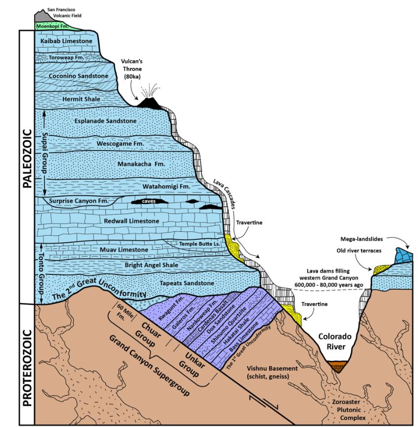
Backyard Geology: Grand Canyon Stratigraphy 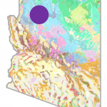
The Grand Canyon is known for the spectacular views of its amazing layers. These layers literally helped geologists write the book on geologic age dating principles.
Online resources:
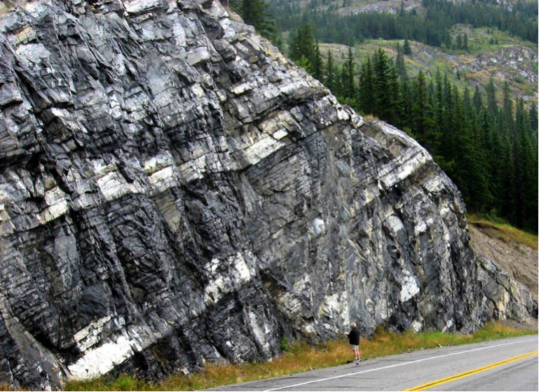
Bedding
Bedding, for example, is the separation of sediments into layers that either differ from one another in textures, composition, color, or weathering characteristics, or are separated by partings—narrow gaps between adjacent beds (Figure 6.7.1). Bedding is an indication of changes in depositional processes that may be related to seasonal differences, changes in climate, changes in locations of rivers or deltas, or tectonic changes. Partings may represent periods of non-deposition that could range from a few decades to a few millennia. Bedding can form in almost any sedimentary depositional environment. Typically in undisturbed sediments laid down by water, bedding appears as horizontal lines.
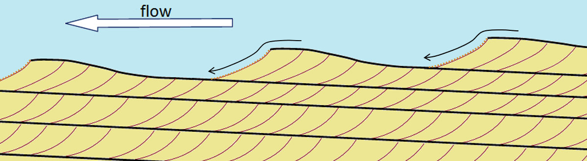
Cross-bedding
Cross-bedding is bedding that contains angled layers within otherwise horizontal beds, and it forms when sediments are deposited by flowing water or wind. Cross-beds formed in streams tend to be on the scale of centimeters to tens of centimeters, while those in aeolian (wind deposited) sediments can be on the scale of meters to several meters.
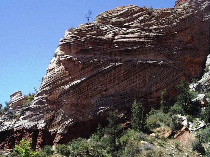
Cross-beds form as sediments are deposited on the leading edge of an advancing ripple or dune under steady state conditions (similar flow rate and same flow direction). Each layer is related to a different ripple that advances in the direction of flow, and is partially eroded by the following ripple (Figure 6.7.3). Cross-bedding is a very important sedimentary structure to be able to recognize because it can provide information on the process of deposition, the direction of current flows and, when analyzed in detail, on other features like the rate of flow and the amount of sediment available.
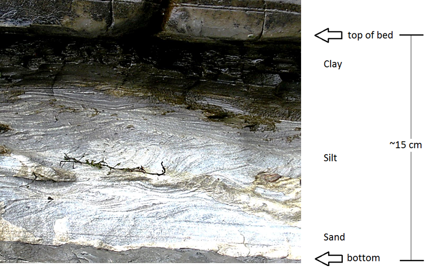
Graded Bedding
Graded bedding is characterized by a gradation in grain size from bottom to top within a single bed. “Normal” graded beds are coarse at the bottom and become finer toward the top. They are a product of deposition from a slowing current (Figure 6.7.4). Most graded beds form in a submarine-fan environment (see Figure 6.7.1), where sediment-rich flows descend periodically from a shallow marine shelf down a slope and onto the deeper sea floor. Some graded beds are reversed (coarser at the top), and this normally results from deposition by a fast-moving debris flow.
Other Sedimentary Structures
Sedimentary structures include all kinds of features contained within sediments and sedimentary rocks that formed at the time of deposition. Bedding is often the most obvious, but there are others that occur commonly and can give an indication about the environment in which the sediments formed.
Ripples
Ripples, which are associated with the formation of cross-bedding, may be preserved on the surfaces of sedimentary beds. Ripples can also help to determine flow direction as they tend to have their steepest surface facing in the direction of the flow (see Figure 6.7.3).
Imbrication
In a stream environment, boulders, cobbles, and pebbles can become imbricated, meaning that they are generally tilted in the same direction. Clasts in streams tend to tilt with their upper ends pointing downstream because this is the most stable position with respect to the stream flow (Figure 6.7.5).


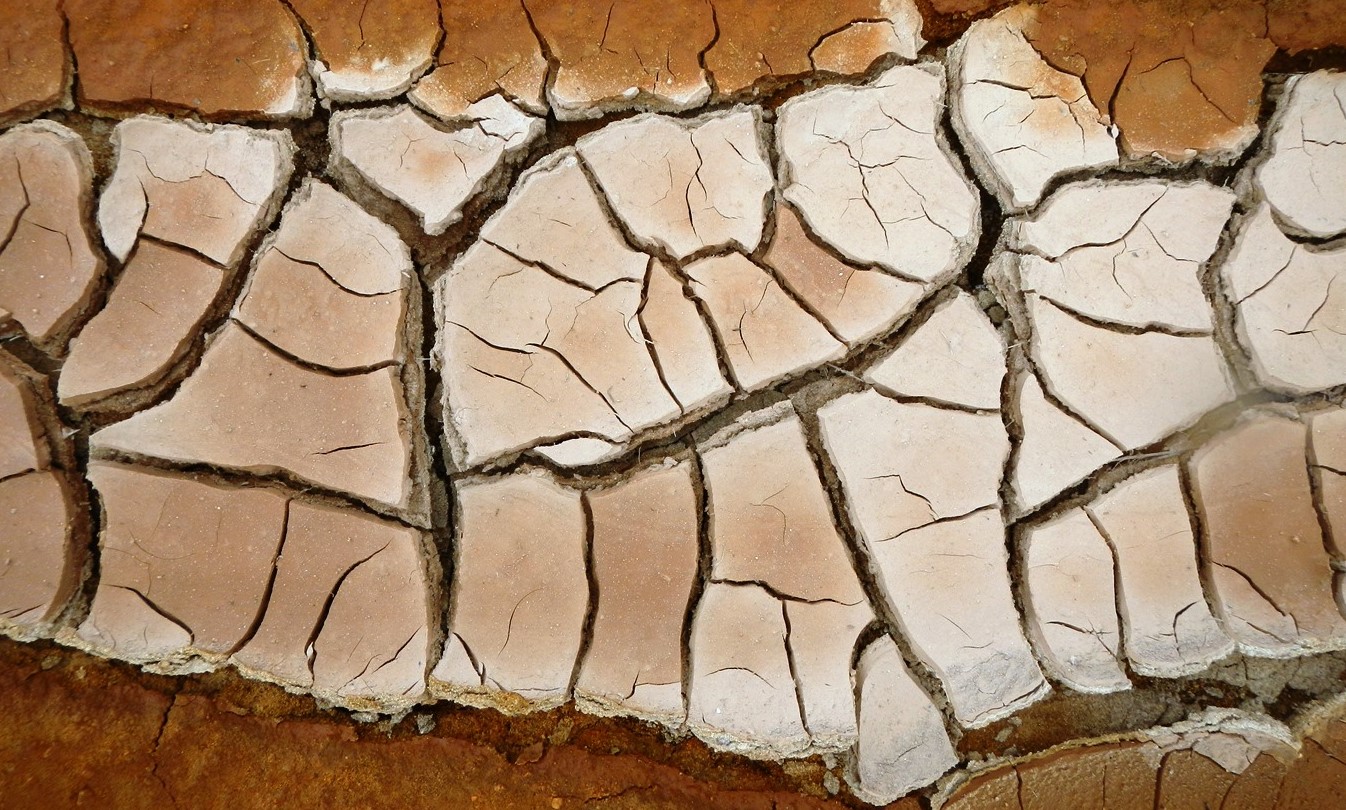
Mudcracks
Mud cracks form when a shallow body of water (e.g., a tidal flat or pond or even a puddle), into which muddy sediments have been deposited, dries up and cracks (Figure 6.7.8). This happens because the clay in the upper mud layer tends to shrink on drying, and so it cracks because it occupies less space when it is dry.
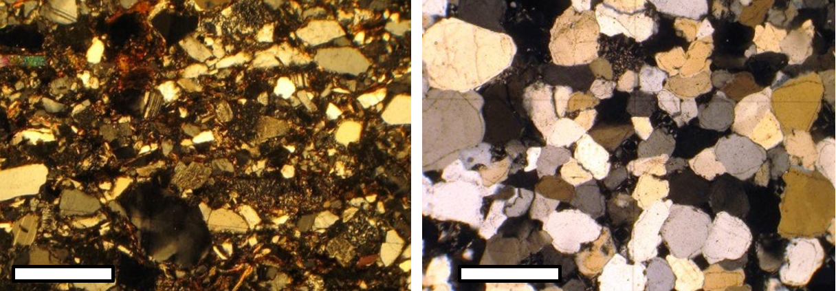
Lithology
The various structures described above are critical to understanding and interpreting the conditions that existed during the formation of sedimentary rocks. In addition to these, geologists also look very closely at sedimentary grains to determine their mineralogy or lithology (in order to make inferences about the type of source rock and the weathering processes), their degree of rounding, their sizes, and the extent to which they have been sorted by transportation and depositional processes. Some of the types of differences that we might want to look for are illustrated in Figure 6.7.8.
Fossils
We won’t be covering fossils in any detail in this book, but they are extremely important for understanding sedimentary rocks. Of course, fossils can be used to date sedimentary rocks, but equally importantly, they tell us a great deal about the depositional environment of the sediments and the climate at the time. For example, they can help to differentiate marine versus terrestrial environments; estimate the depth of the water; detect the existence of currents; and estimate average temperature and precipitation. For example, the tests of tiny marine organisms (mostly foraminifera) have been recovered from deep-ocean sediment cores from all over the world, and their isotopic signatures have been measured. This has provided us with information about the changes in average global temperatures over the past 65 million years.
***See 6.9 for Text and Media Attributions
layers of sediment are originally deposited horizontally under the action of gravity.
in a series of stratified sedimentary rocks the lowest stratum is the oldest
any rock fragments that are included in rock must be older than the rock in which they are included
is based on the observation that sedimentary rock strata contain fossilized flora and fauna, and that these fossils succeed each other vertically in a specific, reliable order that can be identified over wide horizontal distances
layering formed in sedimentary rocks that forms due to flatly deposited sediments
layering within a stratum and at an angle to the main bedding plane.
a systematic change in grain or clast size from one side of the bed to the other.
a system of subparallel wavy ridges and furrows left on sand or mud by the action of water or wind
an overlapping of edges of clasts that all tilt in the same direction
