
1.4 Geography of Plate Tectonics
Now that we understand our Earth’s past and future plate configuration, let’s appreciate our current world map and identify the major plate boundaries on our planet.
View the map on your screen as well as the plate tectonic map below to answer the following questions:
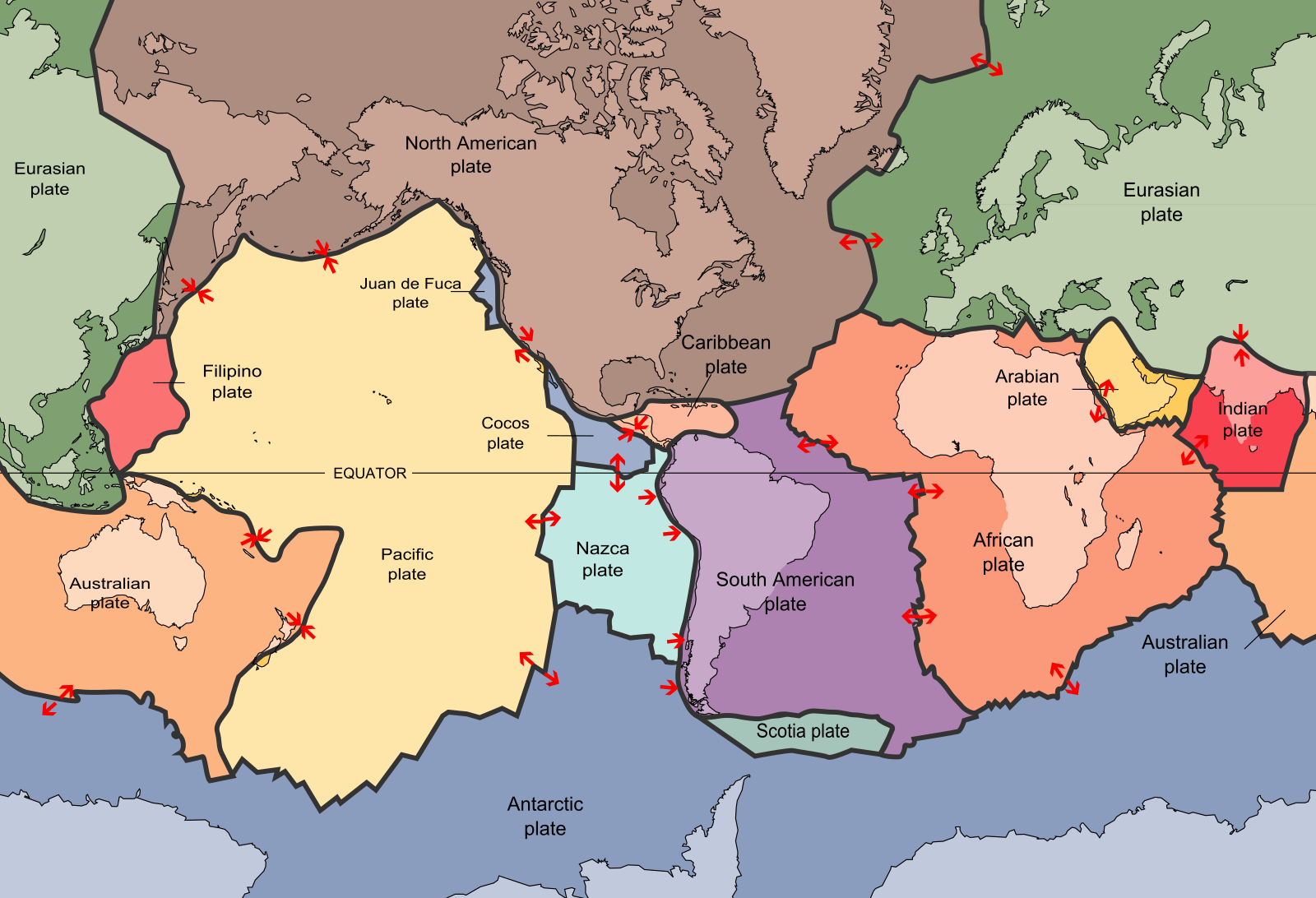
Note: For the questions below, note that the Antarctic, Eurasian and North American plates are exaggerated horizontally in size due to the Earth being a sphere!
In the above map, note that the red arrows indicate the DIRECTION OF PLATE MOVEMENT.
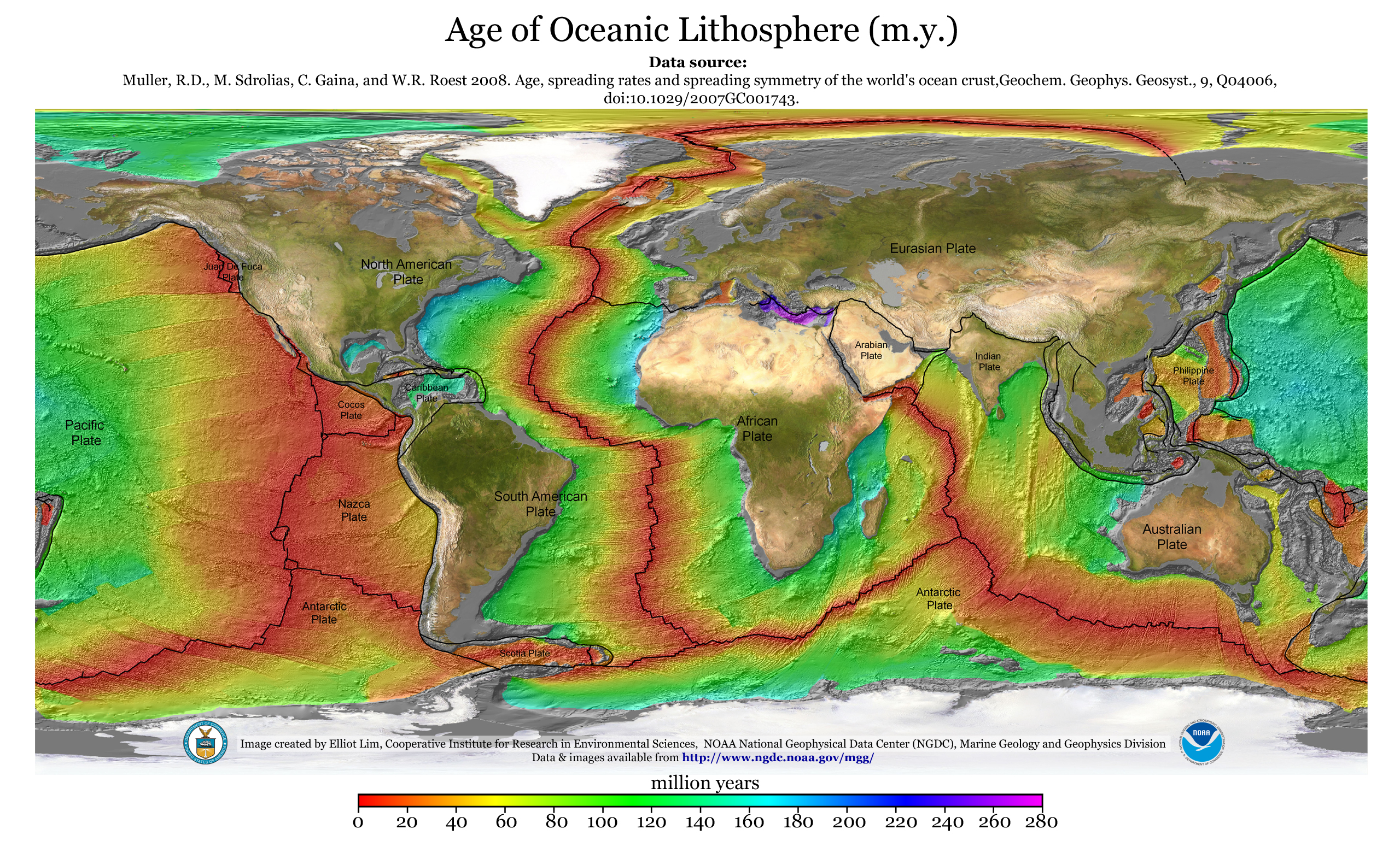
Examine the above image, which shows us the approximate age, in millions of years (m.y.), of the oceanic crust around the world! This is what is called a heat map, which uses false color to illustrate different variables (in this case, age!). Take a look at the legend at the bottom of the map, which will help you decode what each of the colors means.
Try comparing this map to the earlier map above which shows the types of plate boundaries that can be found between the tectonic plates. What patterns do you notice?
For the question below, first find a mid-ocean ridge, such as the East Pacific Rise or the Mid-Atlantic Ridge on the Oceanic Lithosphere Map!
