2.6 Transform Boundaries
Charlene Estrada
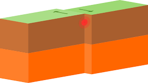
A transform boundary occurs when two tectonic plates move past one another. Shear stress operates at transform boundaries, which involves sliding motion. No lithosphere is destroyed or created, and mountain chains are not built at transform boundaries. Although none of these events occur at transform boundaries, they are far from boring; the continuous stress that builds within the lithosphere from the sliding motion causes faulting and earthquakes.
Most transform boundaries are associated with the spreading spreading centers at mid-ocean ridges. They occur near these divergent boundaries because the spreading rate changes along a ridge. Because the surrounding rock along the ridge is hard and brittle, it accommodates these shifts in spreading rates with sliding motions. Perhaps the most famous transform boundaries, however, are those on the continental lithosphere with effects that are directly felt by nearby cities and towns.
Transform boundaries can cause both large faults and a series of smaller associated faults. Transform faults refer to the lateral displacement of large rock units due to the shearing motion caused by a transform boundary. The motion at a transform fault is classified into two categories: right-lateral and left-lateral. However, these categories are not determined by the composition of the lithosphere. An examination of the two transform faults below demonstrates that they are very similar. Can you notice the difference?
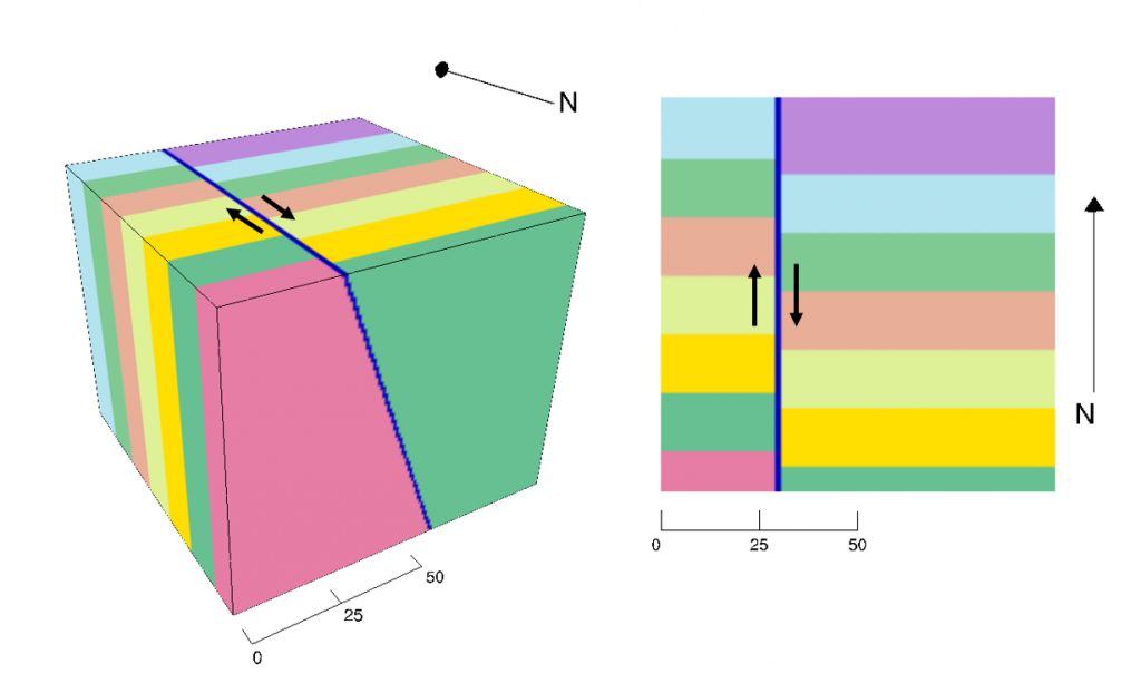
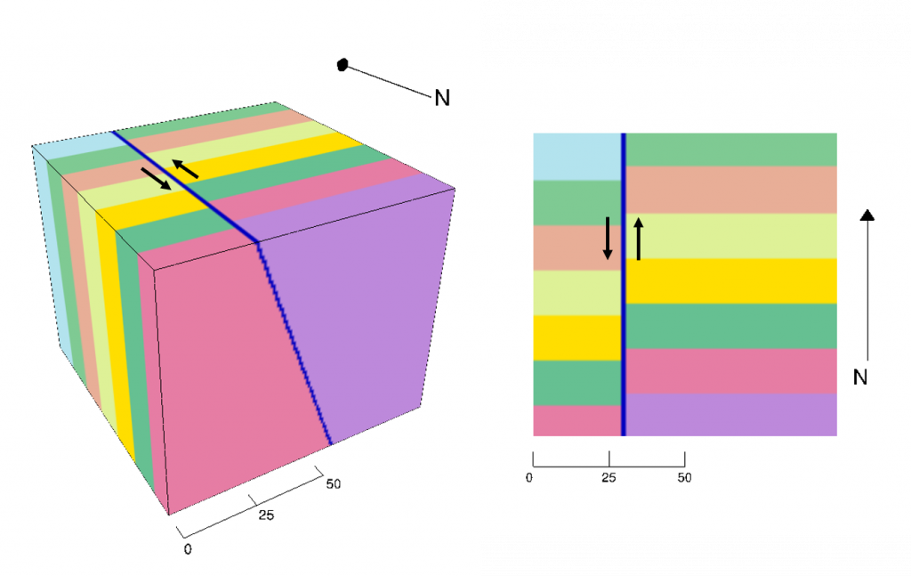
A type of transform plate motion can be identified by examining the two tectonic plates from a bird’s-eye view. For example, below is the Piqiang fault from China:
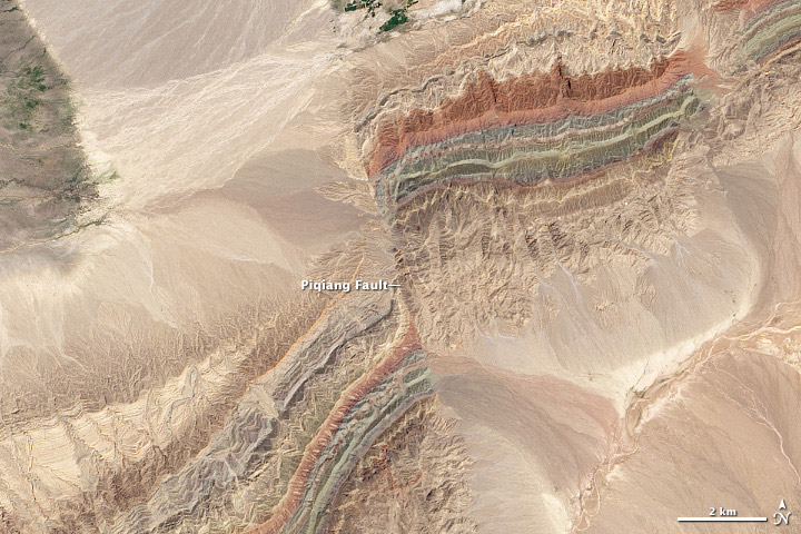
To determine what type of transform fault it is, follow these steps:
- Identify the boundary between the two rock units.
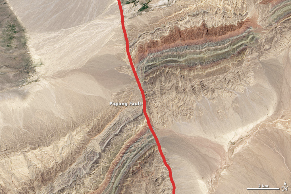
Figure 2.6.5. The red color traces the fault line between rock units. - Find features that have been displaced apart from one another due to the sliding motion of the plates or rock units.
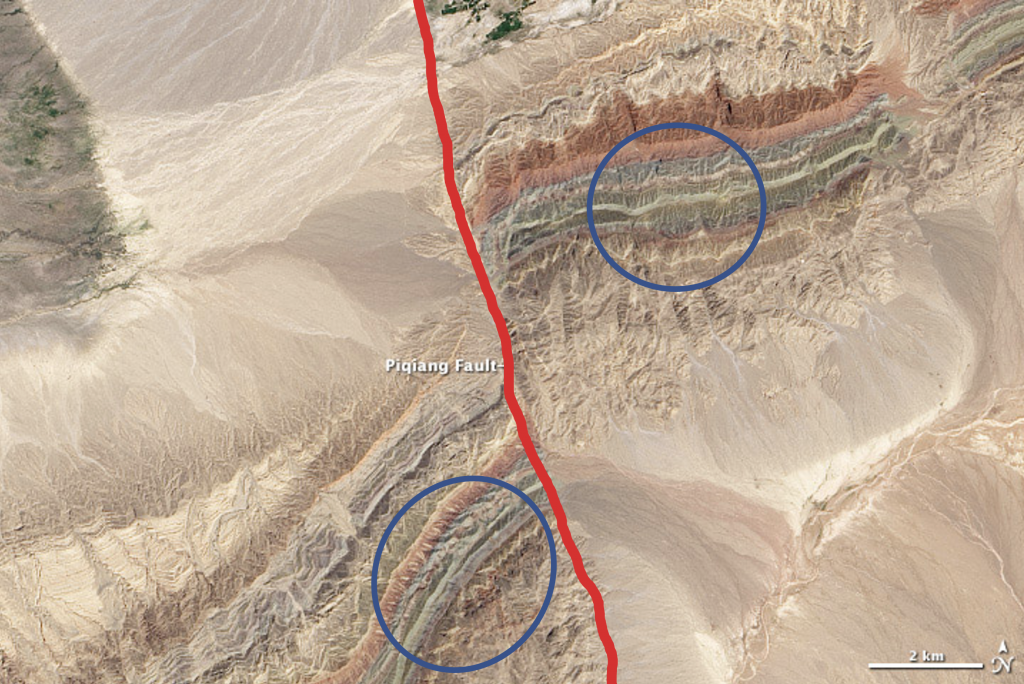
Figure 2.6.6. Blue circles indicate distinctive rock units that have been displaced from one another by the fault. - Based upon those displaced features, decide which rock unit appears to be moving toward you. Which side is it on?
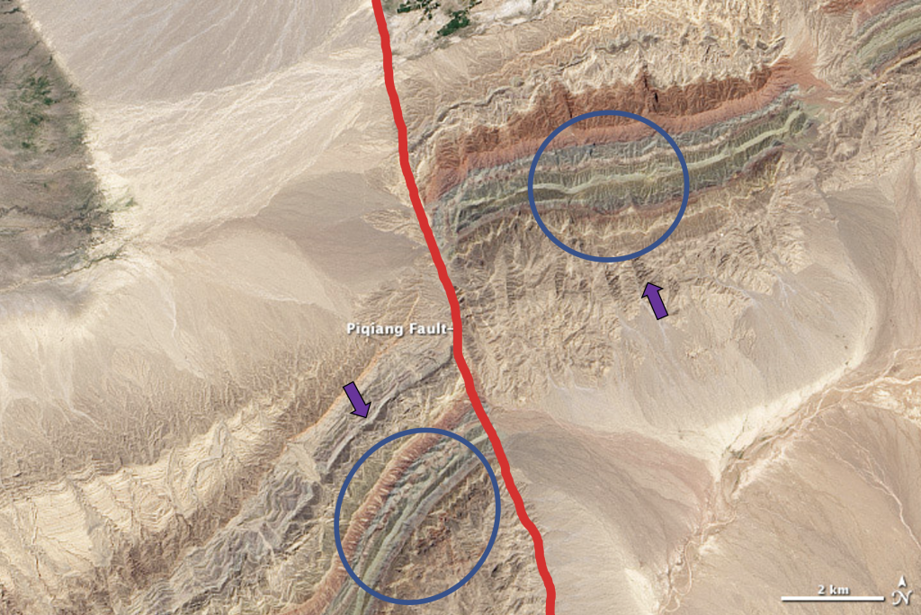
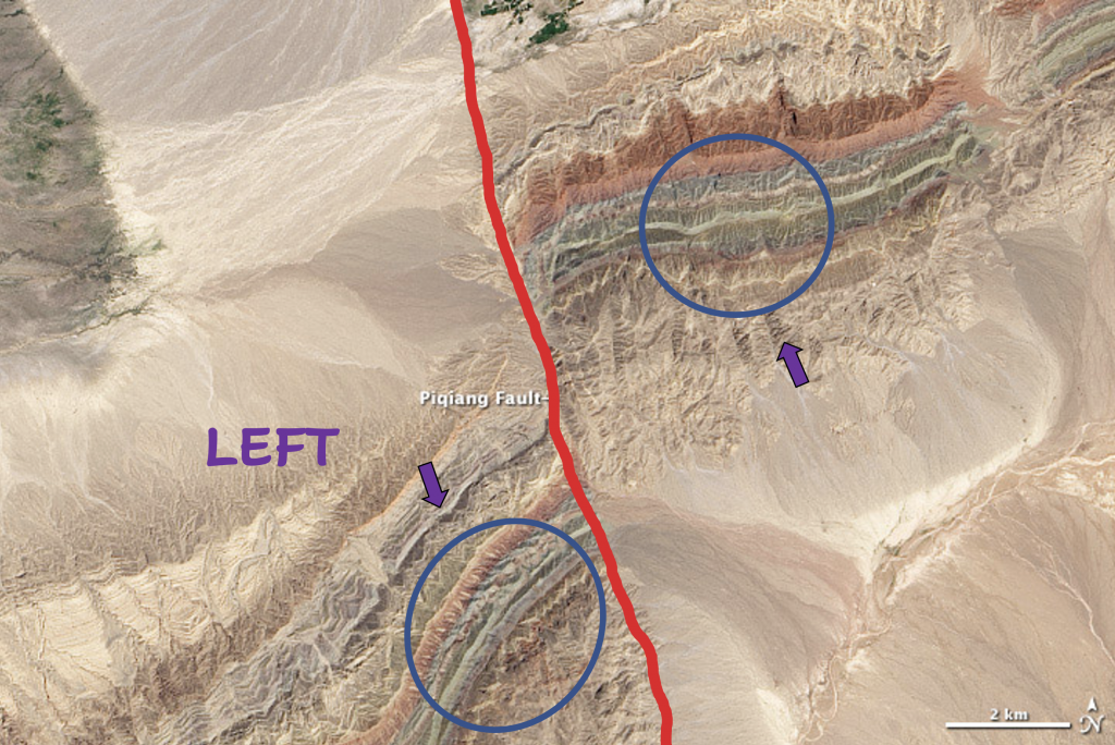
Figure 2.6.7. Purple arrows show the direction the rock units (blue circles) are moving relative to a person looking down the red fault line. - If the plate moving toward you is on the right side, the motion is right-lateral. If it is on the left side, it is left-lateral. This method always works, no matter from which direction you are looking at the boundary!
A region along Earth's lithosphere where at least two tectonic plates slide past one another.
A type of force placed on an area of rock that causes deformation with a sliding motion.
The outer, relatively rigid layer of the Earth that is composed of crust and upper mantle.
An area of breakage or rupture between at least two units of rocks that allows them to move relative to one another.
A region on the ocean floor where magma from an active divergent boundary is creating new oceanic lithosphere, thus pushing or spreading the older lithosphere outwards.
(sometimes abbreviated as "MORs" by scientists) an underwater mountain ridge in the middle of the ocean that is formed by seafloor spreading centers at divergent boundaries.
A region along Earth's lithosphere where at least two tectonic plates move apart from one another.
also called strike slip faults, although these primarily result from the motion of Transform boundaries. These are faults between at least two units of rocks that result in side-by-side or lateral displacement.
a type of strike-slip, or transform, fault in which if you were to stand on the fault boundary, the block moving toward you would be on the right.
a type of strike-slip, or transform, fault in which if you were to stand on the fault boundary, the block moving toward you would be on the left.

