
7.3 Preventing, Delaying, Monitoring, and Mitigating Mass Wasting
Merry Wilson
As already noted, we cannot prevent mass wasting in the long term as it is a natural and ongoing process; however, in many situations there are actions we can take to reduce or mitigate its damaging effects on people and infrastructure. Where we can neither delay nor mitigate mass wasting, we should consider moving out of the way.
Predicting
The best way to predict mass wasting is to understand the factors and triggers associated with events. In addition, a new model from NASA provides near real-time threat tracking through satellite data. The model estimates potential landslide activity triggered by rainfall, the most widespread trigger, and provides it for global analysis. This model could potentially improve estimates of long-term patterns and contribute to future prediction of catastrophic landslide events.
Video 7.3.1.
Preventing and Delaying Mass Wasting
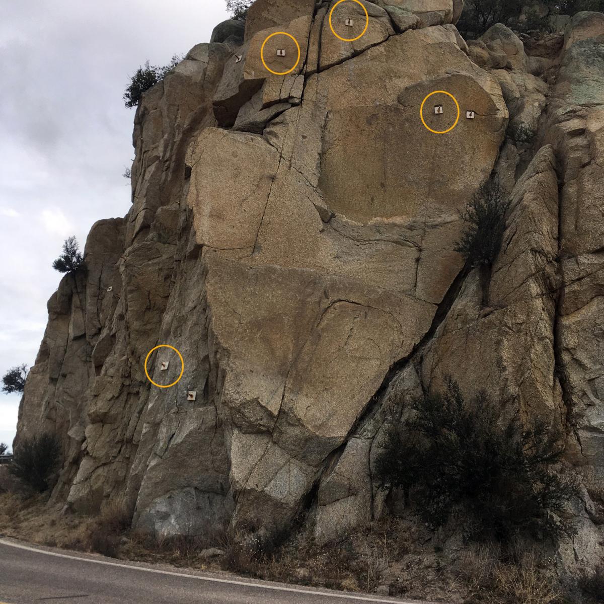
It is comforting to think that we can prevent some effects of mass wasting by mechanical means, such as the rock bolts in a road cut (Fig 7.3.1), or the drill holes used to drain water out of a slope, as was done in Figure 7.2.3, or the building of physical barriers, such as retaining walls. What we have to remember is that the works of humans are mostly insignificant compared to the works of nature. The rock bolts slowly start to corrode after a few years, and within a few decades, many of them will begin to lose their strength. Unless they are replaced, they will no longer support that slope. Likewise, drainage holes will eventually become plugged with sediment and chemical precipitates, and unless they are periodically unplugged, their effectiveness will decrease. Eventually, unless new holes are drilled, the drainage will be so compromised that the slide will start to move again. This is why careful long-term slope monitoring by geological and geotechnical engineers is important at these sites. The point here is that our efforts to “prevent” mass wasting are only as good as our resolve to maintain those preventive measures. (1)
Delaying mass wasting is a worthy endeavor, of course, because during the time that the measures are still effective they can save lives and reduce damage to property and infrastructure. The other side of the coin is that we must be careful to avoid activities that could make mass wasting more likely. One of the most common anthropogenic causes of mass wasting is road construction, and this applies both to remote gravel roads built for forestry and mining and large urban and regional highways. Road construction is a potential problem for two reasons. First, creating a flat road surface on a slope inevitably involves creating a cut bank that is steeper than the original slope. This might also involve creating a filled bank that is both steeper and weaker than the original slope (Figure 7.3.2). Second, roadways typically cut across natural drainage features, and unless great care is taken to reroute the runoff water and prevent it from forming concentrated flows, oversaturating fill of materials can result.

Apart from water issues, engineers building roads and other infrastructure on bedrock slopes have to be acutely aware of the geology, and especially of any weaknesses or discontinuities in the rock related to bedding, fracturing, or foliation. If possible, situations like these should be avoided — by building somewhere else — rather than trying to stitch the slope back together with rock bolts.
It is widely believed that construction of buildings on the tops of steep slopes can contribute to the instability of the slope. This is probably true, but in most cases that is not because of the weight of the building. A more likely contributor to instability of the slope around a building is the effect that it and the changes made to the surrounding area have on drainage.
Backyard Geology: Mitigating a landslide on US-89
In 2013, a landslide destroyed a 23-mile stretch of highway US-89, cutting off a heavily used route to Page, AZ. The repair took almost 2 years and involved literally moving a mountain. Watch the video below from the Arizona Department of Transportation that shows the reopened road!
Video 7.3.2.
Monitoring Mass Wasting

In some areas, it is necessary to establish warning systems so that we know if conditions have changed at a known slide area, or if a rapid failure, such as a debris flow, is actually on its way downslope. Monitoring may occur 24/7 with a range of devices, such as inclinometers (slope-change detectors), bore-hole motion sensors, and GPS survey instruments. A simple mechanical device for monitoring is shown in Figure 7.3.2. The lower end of the cable is attached to a block of rock that is unstable. Any incremental motion of that block will move the cable, which will be detectable on the device. Though a slope may be slow moving, it’s critically important to be able to detect changes in their rates of motion at places with high potential for disaster.
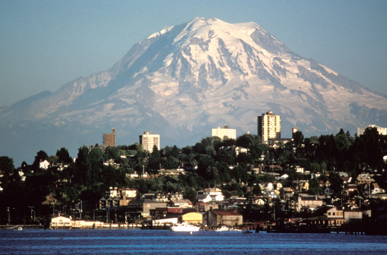
Mount Rainier, a glacier-covered volcano in Washington State, has the potential to produce massive mudflows or debris flows (lahars) with or without a volcanic eruption. Over 100,000 people in the Tacoma, Puyallup, and Sumner areas are in harm’s way because many of them currently reside on deposits from past lahars. In 1998, a network of acoustic monitors was established around Mount Rainier. The monitors are embedded in the ground adjacent to expected lahar paths. They are intended to provide warnings to emergency officials, and when a lahar is detected, the residents of the area will have anywhere from 40 minutes to three hours to get to safe ground. (1)
Mitigating the Impacts of Mass Wasting
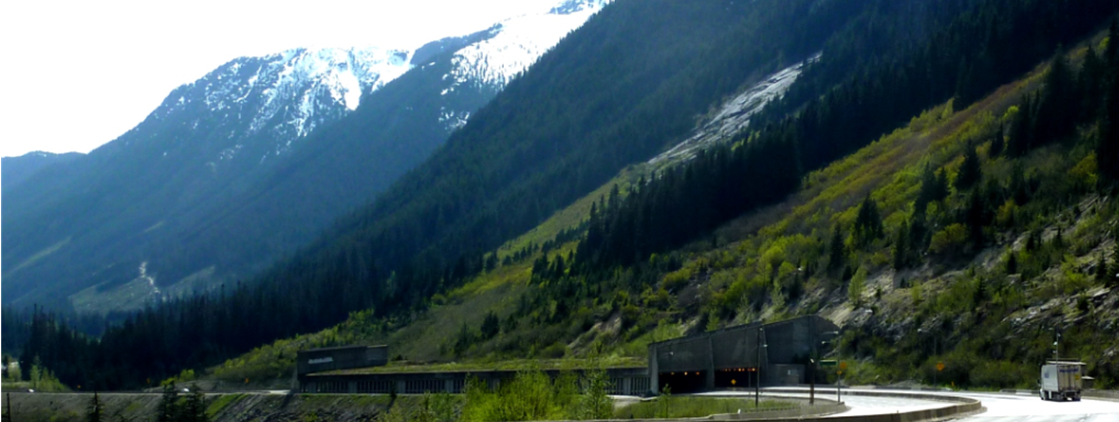
In situations where we can’t predict, prevent, or delay mass-wasting, some effective measures can be taken to minimize the associated risk. For example, many highways in western Canada have avalanche shelters like that shown in Figure 7.3.5. In some parts of the world, similar features have been built to protect infrastructure from other types of mass wasting.
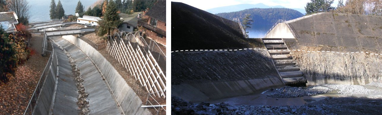
Debris flows are inevitable, unpreventable, and unpredictable in many places. Debris-flow defensive structures can be constructed in drainage basins, as debris follows the same paths as streams. Figure 7.3.5 shows two strategies for dealing with debris flows. One strategy is to allow the debris to flow quickly through to the ocean along a smooth channel. Another is to capture the debris within a constructed basin that allows the excess water to continue through, but catches the debris materials.
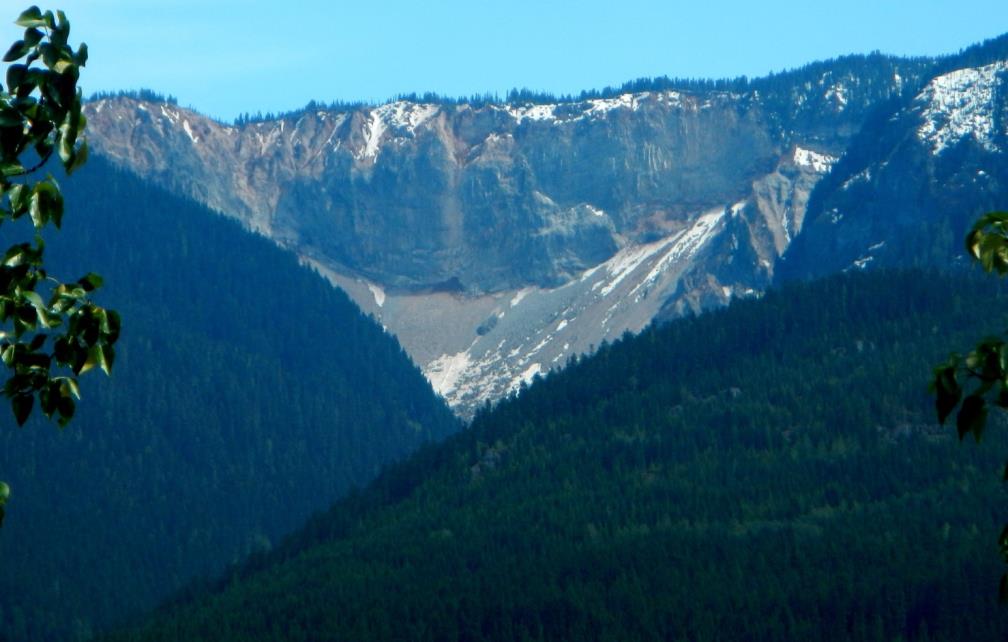
Finally, in situations where we can’t do anything to delay, predict, contain, or mitigate slope failures, we simply have to have the sense to stay away. There is a famous example of this in B.C., Canada, at a site known as Garibaldi. In the early 1980s the village of Garibaldi had a population of about 100, with construction underway on some new homes, and plans for many more. In the months that followed the deadly 1980 eruption of Mount St. Helens in Washington State, the B.C. Ministry of Transportation commissioned a geological study that revealed that a steep cliff (Figure 7.3.6) had collapsed in 1855, leading to a large rock avalanche, and that it was likely to collapse again unpredictably, putting the village of Garibaldi at extreme risk. In an ensuing court case, it was ruled that the Garibaldi site was not a safe place for people to live. Those who already had homes there were compensated, and everyone else was ordered to leave. (1)
A mudflow, or type of mass movement, that is a mixture of water, ash, rock, sediment, and debris that rapidly and suddenly moves downslope. Lahars are a commonly associated hazard with volcanic eruptions.
