
11.2 Midlatitude Cyclones
The polar front theory, also known as the Norwegian model, states that cyclones have a reasonably predictable, six-stage life cycle. We will focus on the northern hemisphere for this section. It all begins along the polar front at 60-65 degrees north, where two very different air masses with different densities meet. Clockwise rotation along with the polar high air mass (cold, dense air) and the subtropical high air mass (warm, less dense air) causes air to flow parallel to each other along the polar front but in opposite directions. Where these two different air masses meet is called a stationary front, and cyclogenesis (formating a mid-latitude cyclone) has begun.
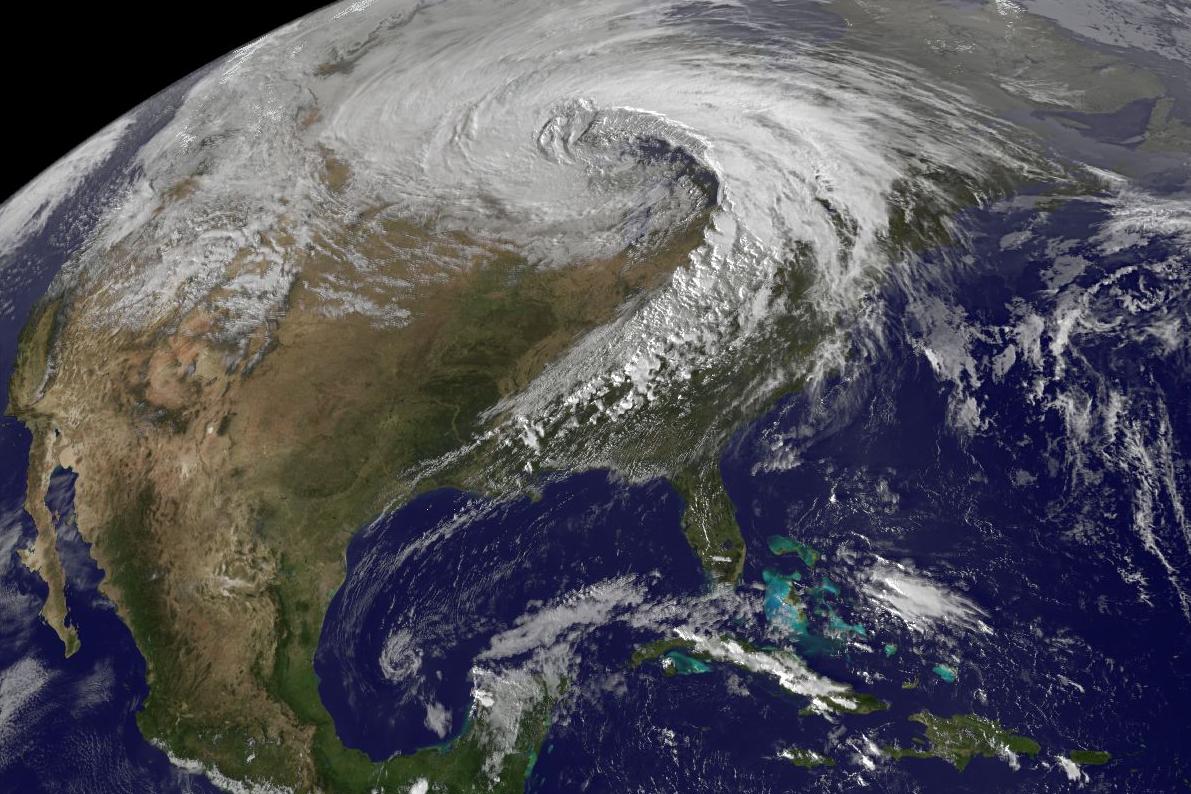
The wind shear, caused by air that flows parallel but in the opposite direction, creates a wave rotating counter-clockwise along the polar front where warm subtropical air begins to migrate northward, and cold polar air migrates southward. In the center of this rotating wave, a low-pressure system develops, rotating counter-clockwise. The advancing boundary of the cold polar air is a cold front, and the boundary of the advancing warm sub-tropical air is a warm front.
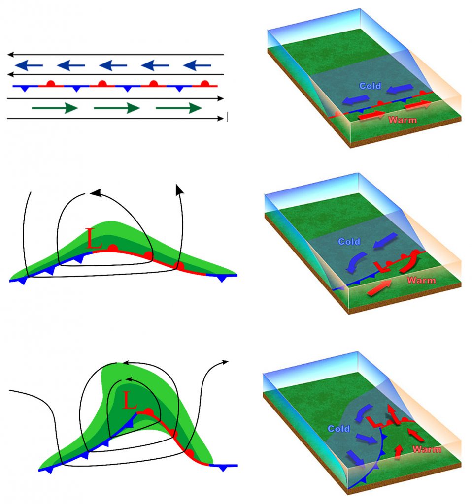
By stage three, the midlatitude cyclone has a defined warm front and cold front. The up-lifting of air begins to occur at this stage as the warmer, lighter, and moister air mass is forced to rise over the colder, denser, and drier air mass. A massive amount of latent heat is being released as water vapor condenses to form clouds. This release of heat strengthens the low pressure (pressure drops more), and the atmosphere becomes more unstable. In front of an advancing warm front, the air would be cool, and stratus-type clouds would begin to develop. As the weather front approaches, the stratus clouds would lower until nimbostratus clouds were overhead.
Typically with warm fronts, the precipitation is light but may last a few days. Once the front passed, it would feel warmer. In front of an advancing cold front, it would be warm at first with warm, southern winds blowing. Cumulus-type clouds would also begin to develop and lower as the cold front approached. Once the cold front is overhead, expect powerful cumulonimbus thunderstorms with the possibility of lightning and thunder, hail, strong winds, and intense precipitation in the form of rain or snow. Once the cold front has passed by, expect colder temperatures and winds from the north or northwest.
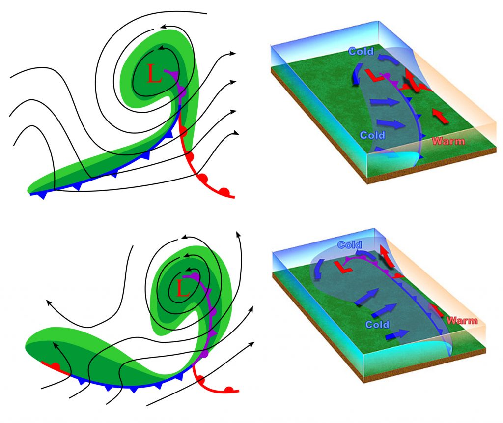
As the days move on, the cold front might begin to “catch up” to the warm front and an occluded front forms. During this stage, the cold front forces the rest of the warm air from the warm front into the upper atmosphere. Now, before the front passes, the air is cool, and afterward, the air is cold. This is when the storm is most intense powerful, as the pressure drops further, and the winds are most intense (indicated by the isobars). However, this also marks the end of the midlatitude cyclone’s life cycle. Once the warm air is forced upward, there is less latent heat and less energy released into the storm. Remember that weather fronts mark the boundary between two high-pressure air masses. So once the midlatitude cyclone moves off, high pressure tends to follow. The results are clear skies, little wind, and pressure rising. (Dastrup, 2014)
