
6.2 Streams and River Systems
Merry Wilson
Streams
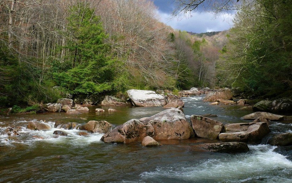
Streams are bodies of water that are in constant motion. Geologists recognize many categories of streams depending on their size, depth, speed, and location. Creeks, brooks, tributaries, bayous, and rivers might all be lumped together as streams. In streams, water always flows downhill, but the form varies with rock type, topography, and many other factors (1).
Path of a Stream
A stream originates at its sources of water, which may be from precipitation, such as high mountains where snows collect in winter and melt in summer, or a spring. It is common for a stream to have more than one source.

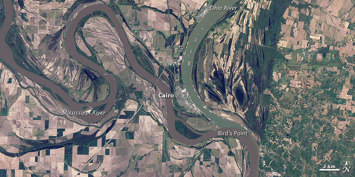
Where multiple streams combine, the smaller stream is called a tributary. In Figure 6.2.3, the Ohio and Mississippi Rivers meet, and the Ohio River is considered a tributary at this junction. Streams will eventually run down the landscape and the water molecules could infiltrate into the ground, evaporate into the atmosphere, or continue to run-off until it intersects with a large body of water, like an ocean or a lake.

Divides and Drainage Basins
A drainage basin is all of the land that is drained by one stream, including its tributaries. A divide is a topographically high area that separates a landscape into different water basins. The rain that falls on the north side of a divide flows into the northern drainage basin, and rain that falls on the south side flows into the southern drainage basin. On a much grander scale, entire continents have divides, known as continental divides.(1).

According to Fig. 6.2.5, the State of Arizona is bracketed by the Great Divide to the east, and the Great Basin to the west.
Discharge and Stream Stage
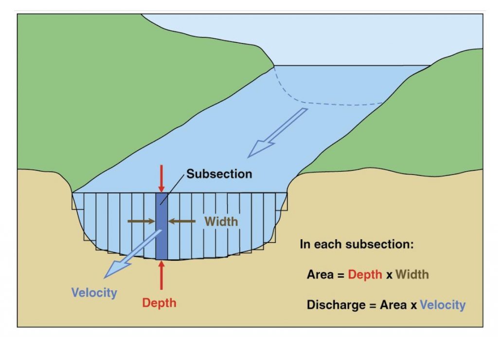
Along the path of the stream, the water volume and velocity may change, depending on the amount of water input and the overall shape and gradient of the stream as it winds through the landscape. This is referred to as stream discharge. Discharge measures stream flow at a given time and location, and specifically is a measure of the volume of water passing a particular point in a period of time. It is found by multiplying the area (width multiplied by depth) of the stream channel by the velocity of the water, and is often in units of cubic feet per second (cfs). Discharge increases downstream in most rivers, as tributaries join the main channel and add water.
Stream stage, sometimes called gage height, is the height of the water at the surface of the stream. Stage zero would be the dry streambed, and stage 1 would be 1 feet above zero. Every stream in every part of the world has a unique calculation of stage and discharge that is related to its unique features.

Backyard Geology: The Colorado River Drainage Basin

Path of the Stream: The Colorado River is nearly 1,450 miles long, beginning with snowmelt, rainwater, and springs in Colorado and Wyoming.
Drainage Basin: The entire basin covers approximately 246,000 square miles and includes all of Arizona (Fig. 6.2.7).
Discharge: The average discharge of the river is highly variable, because it is regulated through a series of dams along the river, as well as extensive use for agriculture. In it’s natural state, the discharge would still be highly variable due to climate but would average about 22,500 cfs, but very little of it typically makes it to the Gulf of California.
When the cloud droplets combine to form heavier cloud drops which can no longer "float" in the surrounding air, it can start to rain, snow, and hail... all forms of precipitation, the superhighway moving water from the sky to the Earth's surface.
a place where water moving underground finds an opening to the land surface and emerges, sometimes as just a trickle, maybe only after a rain, and sometimes in a continuous flow
a stream that flows into a larger stream or river or into a lake
water soaking into the ground
process of evaporation that changes liquid and frozen water into water-vapor gas, which then floats up into the skies to become clouds.
layer of gases that surrounds a planet
precipitation that flows out over the landscape
land area drained by a stream and its tributaries
topographically high area that separates drainage basins
the volume of water moving down a stream at a given time, often measure in cfs (cubic feet per second)
water level in a stream
